








































Weather Storms and Tornadoes Hit Chicago Region
Weather storms and tornadoes hit Chicago and the Midwest, bringing destructive winds, outages and flooding as crews assess damage across Illinois today.
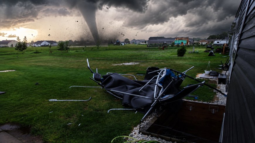
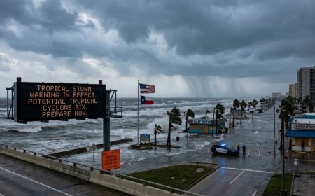
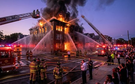
Weather storms and tornadoes battered the Chicago region and other parts of the Midwest, leaving widespread damage, power outages, flooding and major travel disruptions in their wake. At least two tornadoes were reported in the Chicago-area region, but officials and weather experts say destructive straight-line winds were also a major part of the event. Some wind gusts approached or exceeded 95 mph around northern Illinois, while a 99-mph gust was recorded near Gary, Indiana. The National Weather Service said the broader storm system likely qualifies as a derecho, underscoring that the danger extended well beyond individual tornado tracks.
What happened as the storms moved through Chicago?
A fast-moving line of severe thunderstorms crossed the Chicago metropolitan area Tuesday, producing tornado warnings, destructive winds and intense rainfall. The storms moved quickly, which reduced the amount of time residents had to react in some locations. Communities south and southwest of Chicago reported downed trees, damaged roofs, blocked roads and other signs of powerful wind damage.
ABC7 Chicago reported at least two tornadoes connected to the event, with damage reported in areas including Crete, Monee, Orland Park and Flossmoor. However, the tornadoes were only part of the overall threat. A large portion of the damage resulted from straight-line winds associated with the fast-moving storm complex.
That distinction matters because a storm can produce severe and potentially life-threatening damage even when a tornado is not confirmed at a particular location. Strong straight-line winds can uproot mature trees, damage roofs, knock down utility infrastructure and create widespread transportation problems over a much larger area.
Why was the Chicago storm described as a possible derecho?
The National Weather Service indicated that the storm system likely qualifies as a derecho, a type of widespread, long-lived windstorm associated with a fast-moving line of thunderstorms. Derechos can produce extensive straight-line wind damage across a broad corridor, sometimes making the overall footprint of destruction much larger than that of an individual tornado.
That helps explain why Tuesday's event affected such a large portion of the Midwest. The Chicago area experienced powerful winds, while parts of Indiana and Ohio also reported significant damage. A wind gust of 99 mph near Gary, Indiana, was among the most notable observations reported during the event.
The combination of extreme heat, humidity and atmospheric instability helped provide an environment capable of supporting intense thunderstorms. The resulting storm line moved rapidly across the region, bringing multiple hazards at once: damaging winds, tornadoes, heavy rain and localized flooding.
How extensive are the power outages?
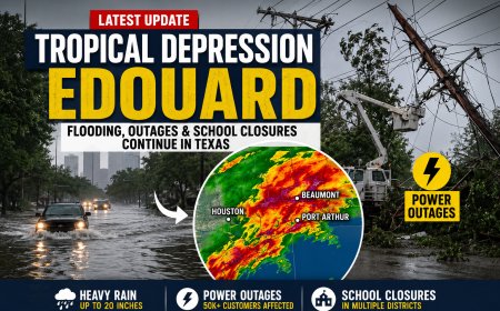
Power outages became one of the most significant consequences of the storm. Hundreds of thousands of customers across Illinois, Indiana and Ohio lost electricity as trees and other debris damaged utility lines and infrastructure. Fresh reporting placed the total number of affected customers across the three states at more than 600,000 during the event.
The Chicago area was among the hardest-hit portions of Illinois. Earlier reporting from the region also documented outages affecting hundreds of thousands of customers, particularly in and around Cook County. Restoration work was continuing as utility crews assessed damaged lines and prioritized repairs.
For residents who remain without electricity, the aftermath can last well beyond the passage of the storm itself. Downed lines, blocked streets and damaged equipment can prevent crews from reaching some locations immediately. Residents should stay away from fallen or damaged power lines and report them through the appropriate utility or emergency channels.
Did a tornado hit Chicago itself?
Reports of a “Chicago tornado” have driven a large share of online searches, but it is important to distinguish the city of Chicago from the wider Chicago metropolitan area. Tornado warnings and confirmed tornado reports covered portions of northeastern Illinois and nearby communities, while much of the severe damage around the region came from straight-line winds rather than a tornado directly passing through downtown Chicago.
Tuesday's storm activity shows why location-specific warnings are important. A tornado warning can cover a defined area even when the tornado itself is outside the city center, while damaging winds from the same storm can affect communities farther along its path.
Residents should therefore rely on official warnings and radar information for their exact location rather than assuming that a social-media post describing a “Chicago tornado” means the entire city is under a tornado threat.
What is the difference between a tornado watch and warning?
The difference between a tornado watch and a tornado warning is especially important during fast-moving severe weather. According to the National Weather Service Chicago office, a watch means conditions are favorable for tornado development. A warning means dangerous conditions are occurring or imminent, based on radar information, reports or other evidence.
When a tornado warning is issued for a person's location, residents should immediately move to a safe shelter rather than waiting for visual confirmation. The safest choice is generally a basement or an interior room on the lowest floor of a sturdy building, away from windows. People outdoors, in mobile homes or in vehicles should seek substantial shelter as quickly as possible.
This distinction is also why a tornado tracker or radar application should not replace official emergency warnings. Radar can help people understand where a storm is moving, but official alerts provide the most important information about immediate danger.
Could more severe weather affect Illinois on Wednesday?
The threat did not completely disappear with Tuesday's storms. Fresh reporting indicates that parts of west-central Illinois face another risk of severe thunderstorms on Wednesday, Aug. 12, although the setup is not the same everywhere and the Chicago area should not automatically be treated as being under a tornado warning.
The Storm Prediction Center risk cited in current reporting places parts of west-central Illinois in a Level 2 of 5 severe-weather risk, with damaging winds identified as the leading concern, along with smaller probabilities for tornadoes and hail. The development of additional storms depends partly on how the earlier storm activity evolves and how atmospheric conditions change during the day.
That means residents should continue checking updated forecasts, especially if they are traveling through Illinois or living in areas where additional thunderstorms are expected. Conditions can change quickly during summer severe-weather events, and a forecast issued several hours earlier may not reflect the latest storm track.
Why are power outages and flooding still a concern after the storm?
The danger from a severe storm does not end when thunder and strong winds move away. Flooded streets, weakened trees, damaged buildings and downed utility lines can create hazards during the recovery period. Heavy rainfall can also overwhelm drainage systems, especially where the ground is already saturated or where stormwater infrastructure is receiving a sudden surge of runoff.
Chicago-area officials and utilities therefore face a second phase of the emergency after the weather system passes: clearing roads, repairing electrical infrastructure, checking damaged structures and responding to residents who remain without power. The storm's effects on airports also demonstrate how infrastructure disruption can continue after the worst weather has moved on.
Safety reminder: During an active tornado warning, do not rely on a single weather app or social-media post. Follow official emergency alerts and seek sturdy shelter immediately. Never approach downed power lines or enter buildings that appear structurally damaged.
What should Chicago-area residents watch next?
The immediate focus is shifting from the initial storm's damage to recovery and the possibility of additional severe thunderstorms. Residents should monitor the National Weather Service, local emergency alerts and reliable radar products for changes in their specific area. The key hazards to watch include damaging wind, isolated tornadoes, hail, heavy rain and localized flooding.
The event also highlights an important point about severe weather in the Chicago region: tornadoes can attract the most attention, but straight-line winds from large thunderstorm complexes can produce equally serious consequences across a much wider area. Tuesday's damage, widespread outages and transportation disruptions show why residents need to prepare for the complete range of severe-weather hazards rather than focusing on tornadoes alone.
As damage surveys continue, some reports may be revised or reclassified by weather officials. Preliminary storm reports are not necessarily final until they have been reviewed and certified. For that reason, confirmed tornado counts, wind measurements and damage assessments should be treated as evolving information during the recovery period.
For readers researching people connected to weather, science or emergency response, read complete biographies at BiographyPoints.com.
What's Your Reaction?
 Like
0
 Dislike
0
 Love
0
 Funny
0
 Angry
0
 Sad
0
 Wow
0