



















































Tropical Depression Edouard Flood Threat Lingers in Texas
Tropical Depression Edouard is weakening over Texas, but dangerous flooding, power outages and school closures continue across Southeast Texas and beyond.
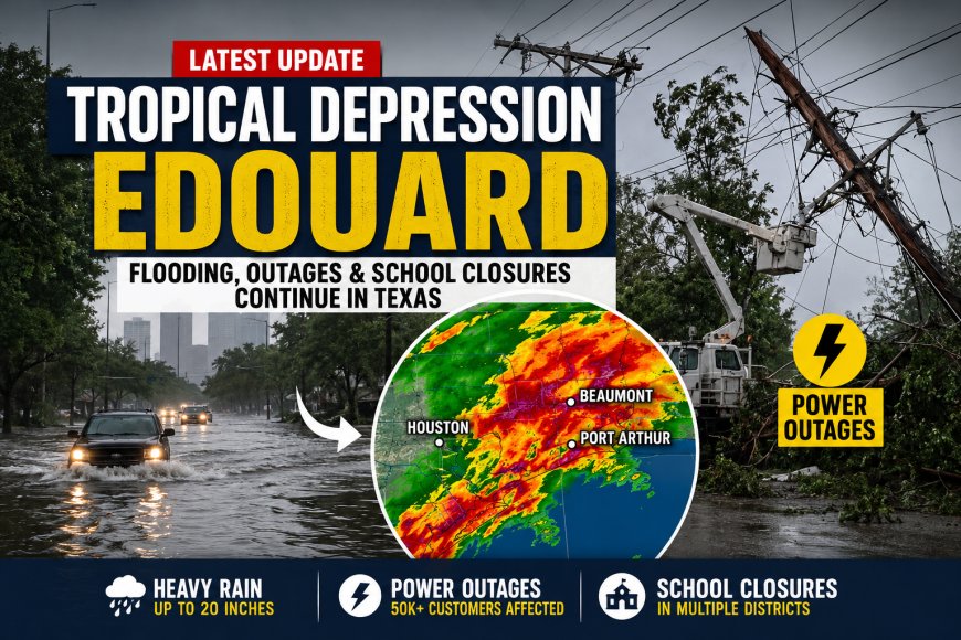
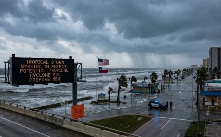
Tropical Depression Edouard is weakening as it moves farther inland across Texas, but the downgrade does not mean the danger is over. The former tropical storm has left parts of Southeast and East Texas dealing with extreme rainfall, flash flooding, downed trees, dangerous roads and widespread power outages. Some locations near the Beaumont area received close to 20 inches of rain, while thousands of customers remained without electricity Wednesday. The National Hurricane Center has ended its tropical-cyclone advisories for Edouard, but the Weather Prediction Center continues monitoring the system because flooding remains a serious threat.
Tropical Depression Edouard is weakening, but flooding remains the main danger
Edouard made landfall Tuesday afternoon near the Texas-Louisiana border as a tropical storm with maximum sustained winds of about 60 mph. Gusts were considerably stronger in some coastal communities, including reports of gusts reaching as high as 90 mph. After moving inland, the system weakened into a tropical depression with maximum sustained winds near 35 mph.
That weakening is important, but it does not immediately remove the biggest threat. Tropical systems can continue producing intense rainfall after their winds fall below tropical-storm strength. In Edouard's case, the rain bands became the central concern as moisture continued spreading across eastern Texas. The National Weather Service warned that heavy rainfall and flash flooding would remain possible as the remnants moved northwestward.
The National Hurricane Center's latest information said Edouard was producing significant flash flooding across East Texas and issued its final advisory on the system. The Weather Prediction Center is continuing flood-related updates because the remaining circulation and moisture can still contribute to dangerous rainfall.
Why Southeast Texas saw such extreme rainfall
The most unusual part of Edouard's impact has been the concentration of very heavy rain over relatively narrow areas. Rainfall totals were not uniform across Southeast Texas. Some communities received several inches, while locations closer to the strongest rain bands received dramatically more.
Radar estimates showed rainfall approaching 20 inches in a narrow corridor near the Hardin-Tyler county line. An official observation near Little Pine Island Bayou was around 18 inches, while other locations around Kountze, Lumberton and Woodville also recorded very substantial totals. The National Weather Service identified a rare high-risk area for excessive rainfall in part of the Piney Woods region as the flood threat expanded inland.
This helps explain why a storm that is technically weakening can still generate dangerous conditions. The greatest risk is no longer necessarily the strongest wind. Instead, saturated ground, rapidly rising water, overflowing waterways and additional rain can create dangerous conditions even after the storm's center has lost tropical-storm strength.
Entergy outage map becomes a major part of the recovery story
Power outages quickly became one of the biggest practical problems after Edouard moved through Southeast Texas. Entergy Texas reported that outages peaked at approximately 80,000 customers Tuesday. By 10:30 a.m. Wednesday, that figure had fallen to about 51,000 after crews restored service to roughly 25,000 customers.
Entergy said more than 1,800 field resources were working across the affected region, including specialized equipment such as helicopters, drones, high-water vehicles and rear-alley machines. Beaumont, Port Arthur, Orange and Silsbee were among the communities experiencing significant impacts. The company said it expected to restore at least 50% of affected customers by the end of Wednesday, although the hardest-hit locations could take longer because flooding, debris and continuing weather conditions can slow repairs.
For residents looking for restoration information, an official utility outage map is more useful than relying on a general storm tracker. Restoration times can change as crews inspect individual lines, substations and other equipment. Entergy also warned residents to stay away from downed power lines and flooded areas while crews work.
Are Houston and nearby communities still at risk?
Houston did not experience the same level of rainfall as some of the hardest-hit areas near Beaumont and the Piney Woods, but the wider Houston region remained relevant to the storm's forecast because rain bands could move through parts of Southeast Texas. The Houston/Galveston National Weather Service office identified heavy rainfall as the primary threat and warned that areas north of Interstate 10 and along and east of Interstate 45 could see additional heavy rain.
The important distinction is location. The most severe flooding has been concentrated farther east and northeast of the Houston area, while impacts around Houston have varied considerably from community to community. Drivers should therefore pay attention to local flood warnings rather than assuming conditions are the same throughout the region.
Why school closings are still being searched after the storm weakened
School closures are another consequence of the storm that can continue after the weather system itself weakens. Flooded roads, power outages, damaged facilities and unsafe transportation routes can make it impossible for districts to reopen immediately.
Several districts in the broader Houston and Southeast Texas region announced closures or schedule changes. Conroe ISD, for example, announced that its schools and district offices would be closed Wednesday because of concerns about heavy rainfall, flooding, power outages and hazardous roads. Beaumont Independent School District also kept campuses closed Wednesday following widespread outages.
Parents should check their individual school district for the latest reopening decision rather than relying on a general list of closures. Conditions can differ significantly even between neighboring communities, particularly when one area has functioning roads and electricity while another is dealing with flooding.
What happens next as Edouard moves across Texas?
The next phase is expected to be dominated by rainfall and recovery rather than hurricane-force winds. Forecast guidance showed the system continuing northwestward through eastern and east-central Texas, with the remaining circulation expected to weaken further and eventually dissipate.
However, the flood risk can outlast the storm's strongest winds. Rivers, creeks and drainage systems may continue rising after the heaviest rainfall has moved away. The National Weather Service continued to carry flood concerns in parts of eastern Texas, including areas where watches and warnings remained active.
That means residents in flood-prone locations should not treat the disappearance of the tropical-storm designation as an all-clear. Water can remain on roads, additional rain can fall over already saturated ground, and electrical hazards can persist around damaged infrastructure.
Edouard was not a hurricane despite some searches for “Hurricane Edouard”
One clarification matters for readers searching online: Edouard did not become a hurricane during this event. It made landfall as a tropical storm with maximum sustained winds of 60 mph and then weakened into a tropical depression after moving inland.
The phrase “Hurricane Edouard” is appearing in search activity because people often use hurricane as a general term for tropical systems. But technically, the correct description for the current system is Tropical Depression Edouard, while the strongest stage during its landfall was Tropical Storm Edouard.
For Southeast Texas, the central question is therefore no longer whether Edouard can strengthen again. The bigger concern is how quickly floodwaters recede, how much additional rain falls, and how rapidly utilities and local authorities can restore normal services. Even as the tropical system fades, the effects of its rainfall can continue into the days that follow.
What's Your Reaction?
 Like
0
 Dislike
0
 Love
0
 Funny
0
 Angry
0
 Sad
0
 Wow
0